
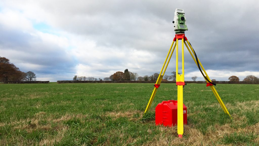
Topographical Surveys for Planning, Design & Construction
Cura Surveys provides accurate topographical surveys for architects and planning consultants, developers and property professionals, and construction and civil engineering teams across London, Surrey and the UK.
We capture the levels, features, structures and surrounding context of a site, giving your project team reliable information for feasibility, planning, design, construction and asset management.
Using total stations, satellite survey equipment, 3D laser scanning, mobile scanning and drone surveys, we can provide comprehensive coverage of development sites, complex urban locations, large estates, woodland, infrastructure and waterside environments.
For enquiries received Monday to Friday, 9am–5pm, where sufficient project information has been provided.
Regulated by RICS | Director-led Service
9+ Years in Business | 3,600+ Projects Delivered
What Is a Topographical Survey?
A topographical survey creates an accurate measured record of the existing land and visible site features.
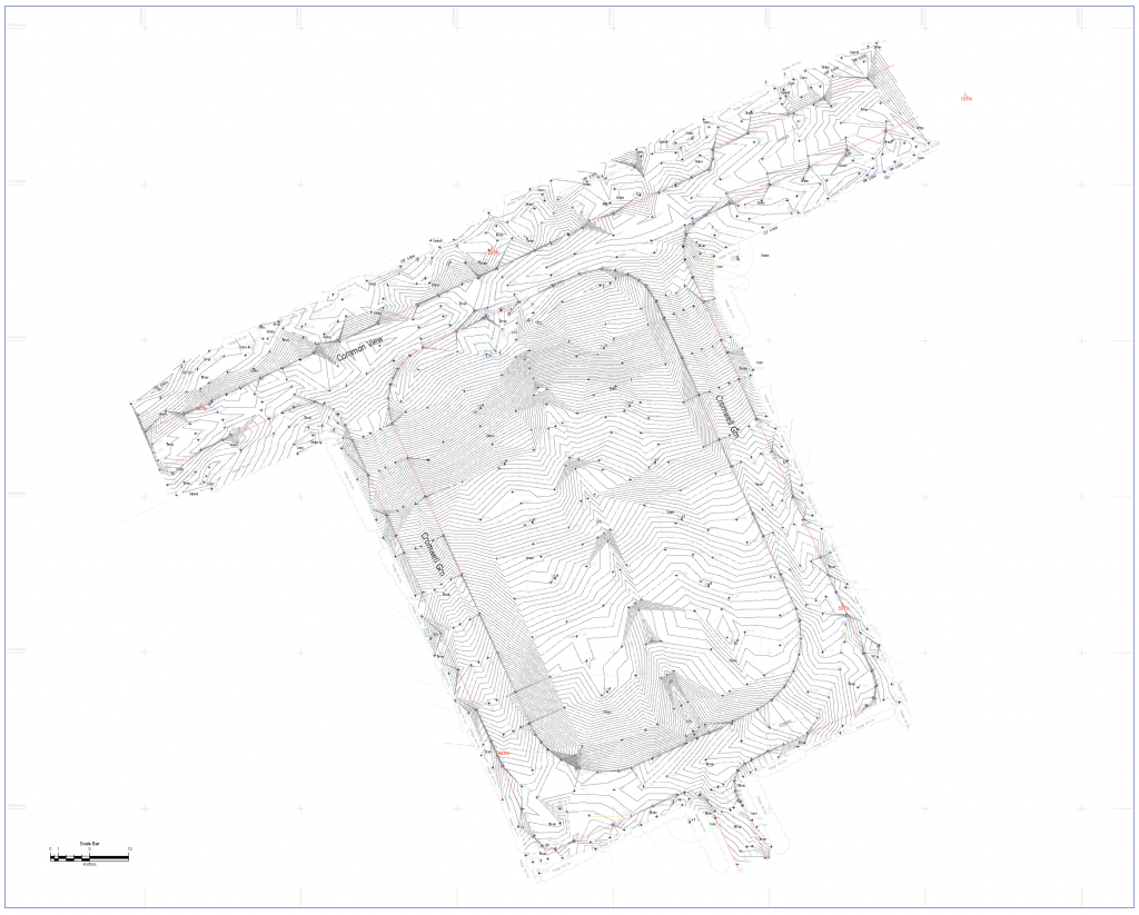
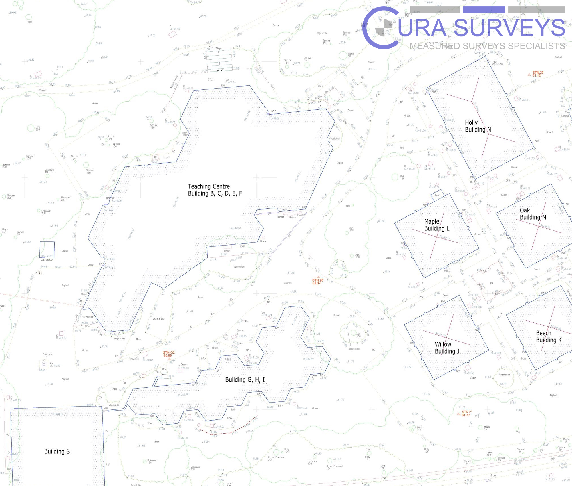
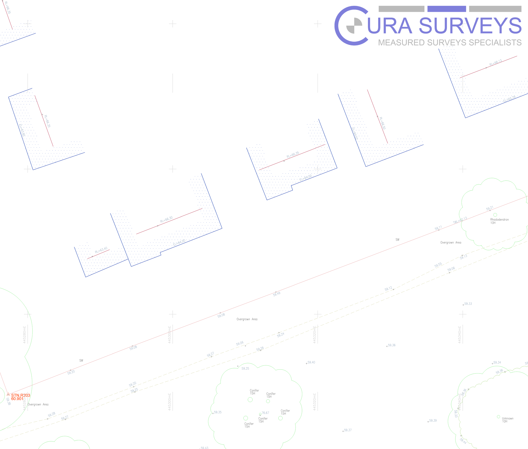
The survey shows the position, height and relationship of buildings, boundaries, roads, trees, drainage features, structures and changes in ground level. This information is normally presented as a coordinated CAD drawing containing spot levels, contours and feature descriptions.
The required survey extent, accuracy, grid, level datum and deliverables are agreed before work begins.
Reliable Site Information for Informed Decisions
Topographical survey information is often the starting point for planning and design.
It helps project teams understand:
- Existing ground levels and slopes
- Site access and development constraints
- The relationship between buildings and surrounding land
- Drainage patterns and level changes
- Neighbouring buildings and site context
- Trees, boundaries and physical obstructions
- Roads, pavements and external structures
- Potential areas for development or alteration
Accurate existing information allows architects and engineers to design from measured data rather than relying on outdated drawings, mapping or assumptions.
What Can Be Included?
Depending on the agreed scope, our topographical surveys can record:
- Spot levels and contours
- Ground surfaces and changes in level
- Buildings and structures
- Roof, eaves, parapet and ridge levels
- Roads, kerbs and pavements
- Paths, parking and access areas
- Walls, fences, hedges and physical boundaries
- Retaining walls and embankments
- Trees, vegetation and landscaped areas
- Drainage covers, gullies and chambers
- Visible utility features
- Street furniture and signage
- Water edges, banks, ditches and channels
- Adjacent buildings and surrounding context
- Window positions and building heights where required
The survey scope can be tailored to the planning, design or engineering requirements of the project.

Why Choose Cura Surveys?
- RICS-regulated survey company
- More than 20 years of professional surveying experience
- Experienced land, building and engineering surveyors
- Total station, satellite positioning, laser scanning, mobile scanning and drone capability
- Building, land, utility, drainage and water surveys from one coordinated team
- Accurate CAD, point cloud and Revit deliverables
- Experience with complex urban sites, large estates and difficult terrain
- Clear survey scopes, grids, datums and deliverables
- In-house survey processing and quality control
- Practical support from quotation through to project delivery
Our aim is not simply to produce a site drawing. We provide clear, reliable information that helps the project team understand the site and make informed decisions.
Posted on GoogleTrustindex verifies that the original source of the review is Google. We were particularly happy with how easy the whole process was to organise, from start to finish. Communication was clear and prompt throughout, and Lei was professional, friendly, and completely unobtrusive while carrying out the survey. The drawings are excellent and very clear, and we would happily recommend this company to anyone looking for this service.Posted on GoogleTrustindex verifies that the original source of the review is Google. Cura Surveys were wonderful. It took very little time to organise an appointment to measure my flat, and the measured survey came through on time. Additionally, Lei was kind enough to send me a PDF version with some specific measurements I needed which were otherwise very hard for me to calculate given that I don't have the software my architects/designers have.Posted on GoogleTrustindex verifies that the original source of the review is Google. Very efficient and professional.Posted on GoogleTrustindex verifies that the original source of the review is Google. Excellent service.Posted on GoogleTrustindex verifies that the original source of the review is Google. Cura Surveys offer & deliver a first class, attentive service. They are flexible and efficient. And the quality of the survey outputs are great. I thoroughly recommend Lei & the team.Posted on GoogleTrustindex verifies that the original source of the review is Google. Well donePosted on GoogleTrustindex verifies that the original source of the review is Google. We approached Lei for a building & topological survey in preparation for planing, such a lovely person and the plans were off a very high standard. I would strongly recommend this company, plans came back in a week, easy communication and very professional. My architect is very happy. They are also very reasonable with costs. Excellent all rounder. Thank you Lei. A very happy customer. ChantalPosted on GoogleTrustindex verifies that the original source of the review is Google. We are an Engineering company based in London and have worked with Lei on several occasions on various projects within the construction industry. The quality of scans are always excellent quality, and provide a very efficient service. We look forward to working with Cura surveys in the future.Posted on GoogleTrustindex verifies that the original source of the review is Google. We used Cura Surveys for two of the residential projects we have been involved with and we’re impressed with their level of professionalism. They were courteous on site and provided a complete and high quality survey. Wouldn’t hesitate to recommend.
For enquiries received Monday to Friday, 9am–5pm, where sufficient project information has been provided.
More Complete Coverage Through Combined Survey Methods
No single survey method is suitable for every site.
Cura Surveys combines different technologies to maximise coverage, accuracy and efficiency.
Total Station and Satellite Surveying
Total stations and satellite survey equipment provide accurate site control, coordinates, levels and detailed measurements across the survey area.
The survey can be connected to an appropriate national coordinate and level system or established on an agreed local project grid.
Tripod Laser Scanning
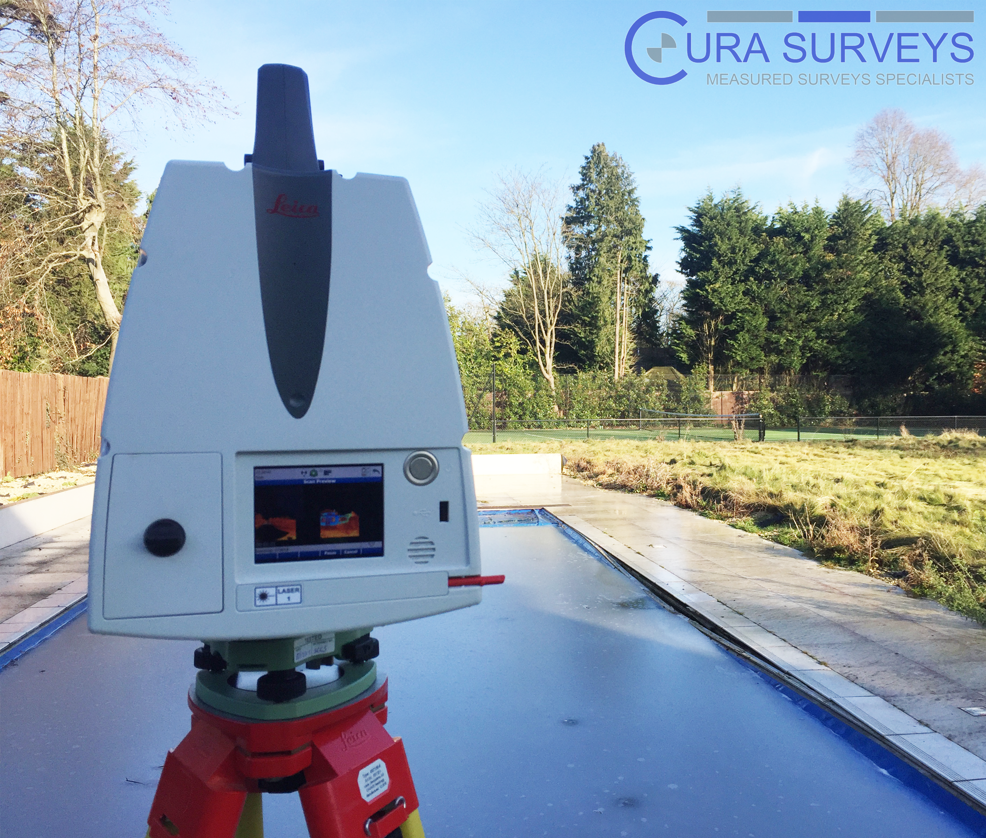
Tripod laser scanning captures detailed three-dimensional information around buildings, structures, complex levels and areas where traditional point-by-point measurement would provide limited detail.
Mobile Scanning
Mobile scanning can cover large sites, access routes, courtyards, internal connections and extensive external areas efficiently.
Drone Surveys
Drone surveys can capture roofs, high-level features, large areas and locations that are difficult or unsafe to observe from ground level.
The drone data can be coordinated with ground survey control to support aerial imagery, roof information, point clouds and three-dimensional site records.
Specialist Survey Data
Where required, the topographical survey can also be combined with:
- Measured building surveys
- PAS128 utility surveys
- Drainage CCTV surveys
- Hydrographic and bathymetric surveys
- Engineering surveys
- Roof and surrounding-area surveys
- 3D laser scanning and Revit modelling
This creates one coordinated dataset rather than several disconnected surveys.
Surveys for Planning and Development
Our topographical surveys support:
- Planning applications
- New-build developments
- Residential and commercial extensions
- Airspace and infill developments
- Site feasibility assessments
- Landscape and public-realm design
- Drainage and external works design
- School and estate improvements
- Regeneration programmes
- Highway and infrastructure projects
- Construction planning
- Environmental and water projects
For projects involving existing buildings, we can combine the topographical survey with accurate floor plans, roof plans, elevations, sections and Revit models.
Surrounding Buildings and Planning Context
The main site boundary is not always enough for planning and design.
For extensions, new developments, airspace schemes and infill projects, the survey may also need to record:
- Neighbouring building footprints
- Ridge, eaves and parapet heights
- Surrounding windows and openings
- Adjacent roof forms
- Road and pavement levels
- Nearby structures and walls
- Access routes
- Relevant surrounding land levels
Our combination of ground surveying, laser scanning, telescopic scanning and drone technology helps capture difficult or partially hidden areas and provides more complete information for planning and design decisions.
Survey Deliverables
Depending on the project requirements, we can provide:
- AutoCAD DWG drawings
- PDF survey plans
- Spot levels and contours
- Three-dimensional survey data
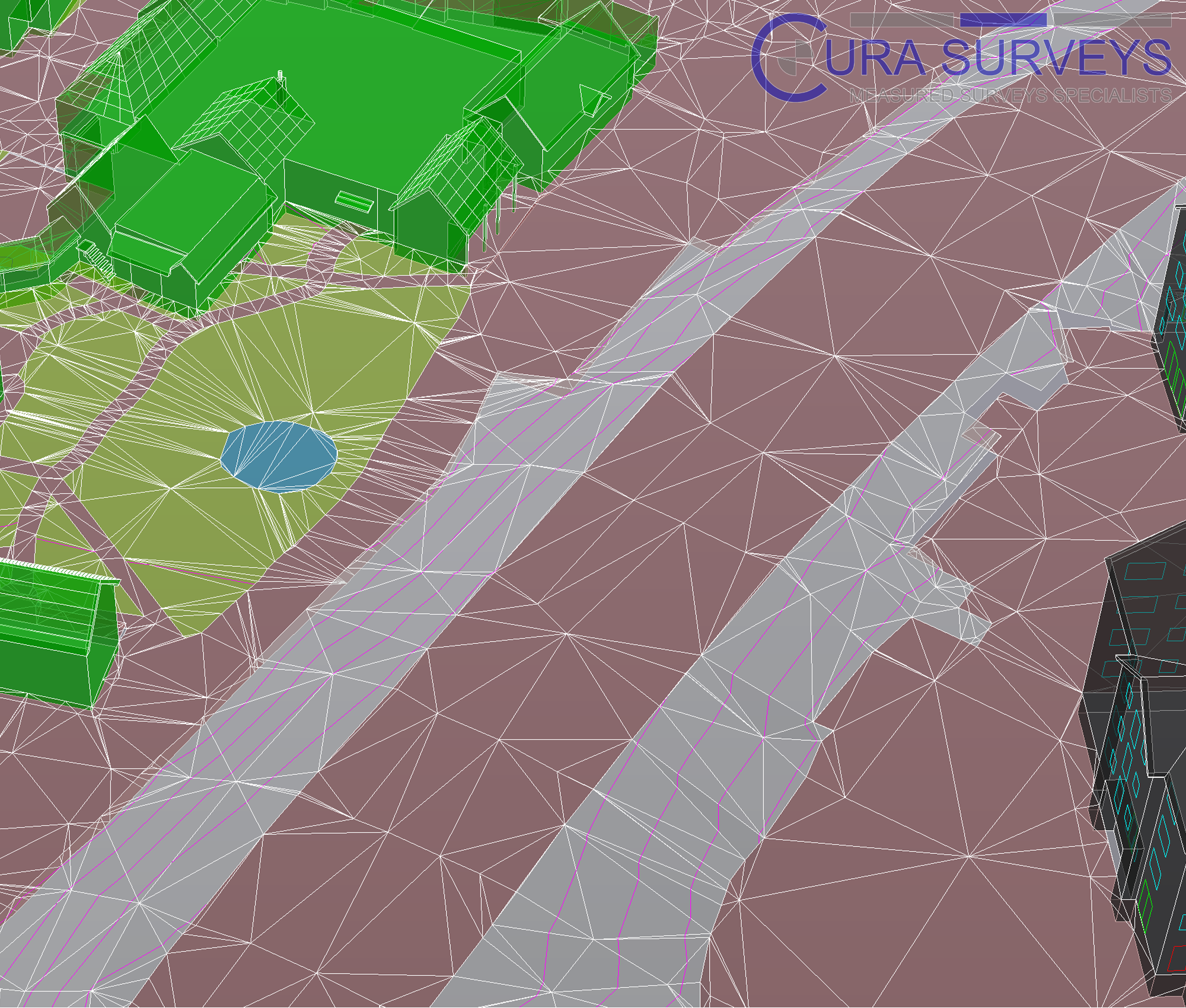
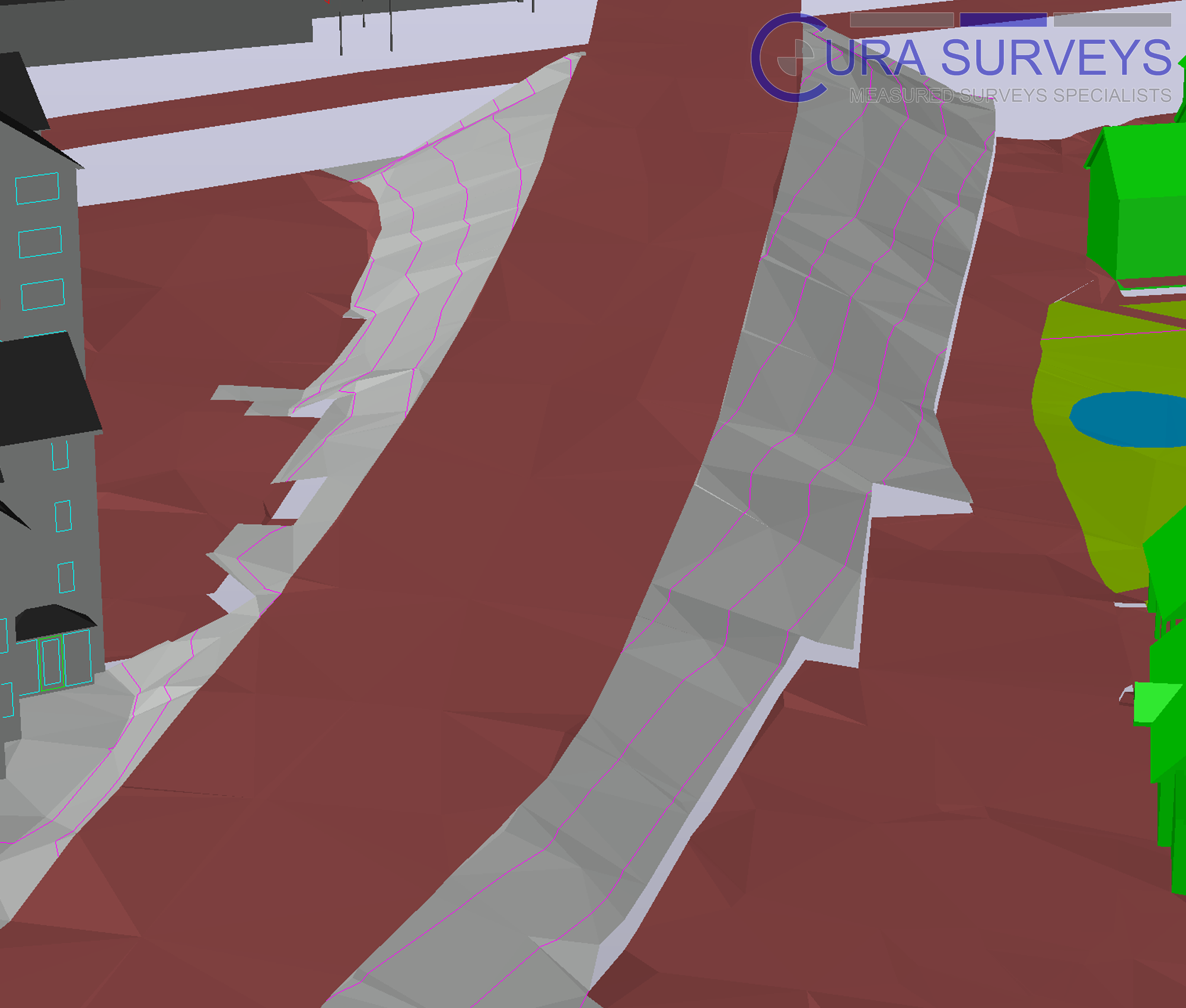
- Digital terrain models
- Surface models
- Breaklines and feature strings
- Registered point clouds
- E57, RCP, RCS, LAS or LAZ files
- Aerial photography
- Roof and surrounding-building information
- Revit or BIM-ready survey information
- Coordinate schedules and survey-control information
Deliverables can be prepared for use by architects, civil engineers, landscape architects, drainage consultants, contractors and other project specialists.

London Borough of Sutton — High Street Regeneration
Survey support across more than 20 sites for the Sutton High Street regeneration scheme, including full measured surveys, Revit BIM models, topographical surveys and multi-stakeholder project support.
Services: Measured Building Survey, Revit BIM, Topographical Survey, Regeneration Survey
Grand Union Canal
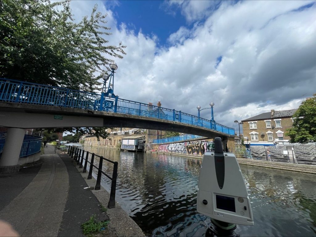
Large topographical survey and 3D laser scanning project along a canal environment, capturing site levels, structures and existing conditions.
Services: Topographical Survey, 3D Laser Scanning, CAD Drawings, Point Cloud Data
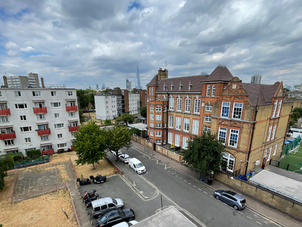
London Borough of Southwark
Revit BIM and topographical survey package supporting airspace development, infill opportunities, planning review and existing-building assessment.
Services: Revit BIM Survey, Scan to BIM, Topographical Survey, Airspace Survey
We normally need the site address, a marked survey extent, the required features, grid and datum requirements, preferred deliverables and project deadline. Existing plans, planning drawings or site photographs are helpful.
A standard topographical survey records visible surface features. PAS128 underground utility mapping using available records, electromagnetic locating and ground penetrating radar can be added where required.
A topographical survey records visible physical boundary features such as walls, fences and hedges. It does not by itself determine the legal boundary. Boundary review and interpretation can be provided under a separately agreed scope.
Yes. Relevant building footprints, roof levels, elevations, windows and surrounding site features can be included where required and accessible or visible.
Yes. The survey can be connected to an appropriate national coordinate and level system where required, or completed on an agreed local project grid and datum.
Yes. We can combine the topographical survey with measured building surveys, including floor plans, elevations, sections and roof plans, together with point clouds and Revit models.
Standard delivery is AutoCAD DWG files plus PDFs. We can also provide Revit models through Scan to BIM, point cloud data in E57 or RCP format, and other formats on request.
Measured building surveys document building layouts, dimensions, elevations, sections and architectural features. Topographical surveys capture external site features such as boundaries, drainage, vegetation and ground levels. Many complex or commercial projects require both as one coordinated survey package.
Call us on 0203 488 5858 or email info@curasurveys.co.uk with your project details. We’ll provide a clear no-obligation quote (with no hidden costs) and feasible timescales.