Scan to BIM / Scan2BIM
Cura Surveys provides professional Scan to BIM surveys for architects, engineers, developers, contractors and property owners who need reliable existing building information before design, planning or construction work begins.
Using 3D laser scanning, point cloud processing and Revit modelling, we capture accurate site data and convert it into detailed BIM ready models, CAD drawings and point cloud deliverables. This gives your project team a dependable digital record of the existing building, helping reduce design risk, avoid site clashes and support better decision making from the outset.
What is Scan to BIM?
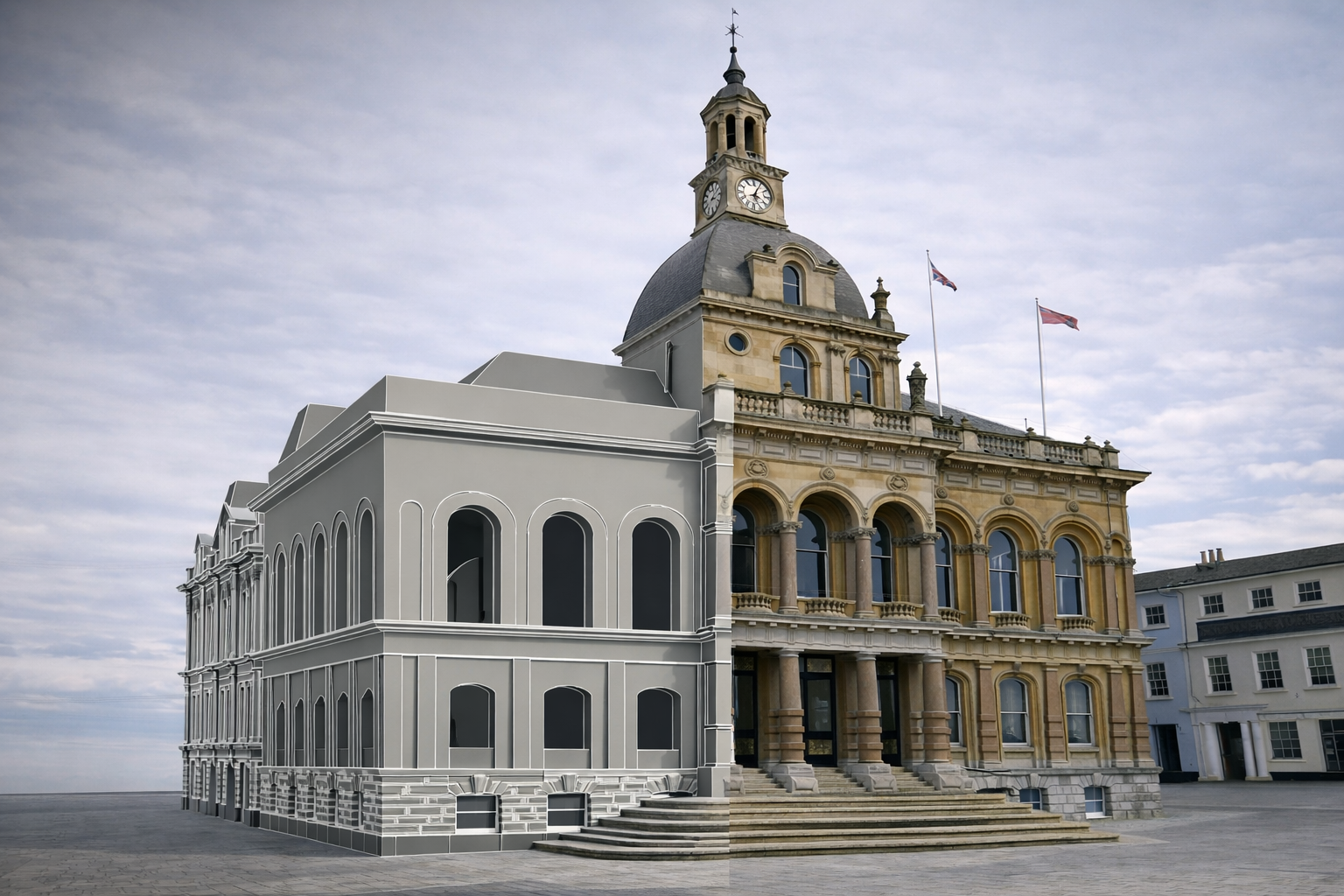
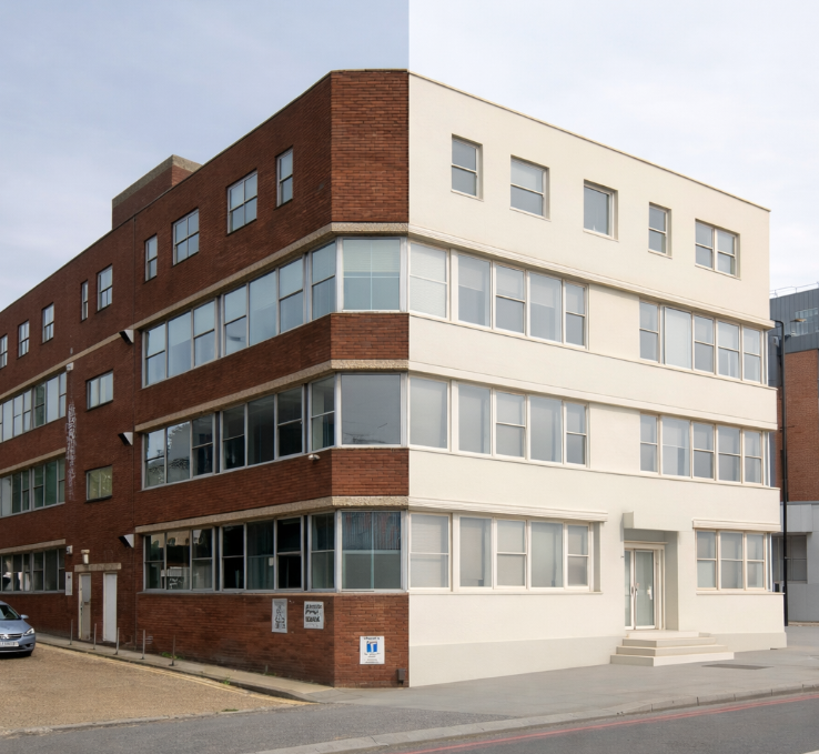
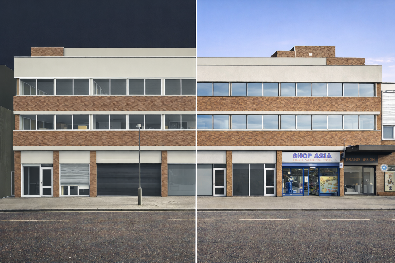
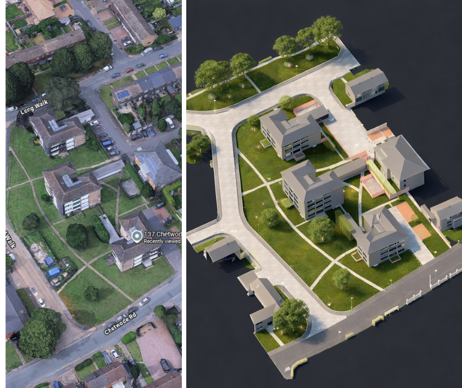
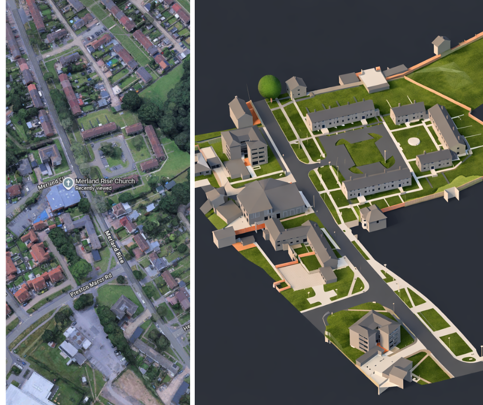
Scan to BIM is the process of capturing a building or site using 3D laser scanners and converting the captured point cloud into a Building Information Model, usually in Revit.
The laser scan records millions of accurate measurement points from the existing structure. This data is then used to create a 3D model showing walls, floors, ceilings, roofs, structural elements, openings and other key building features.
A Scan to BIM survey is especially useful when existing drawings are missing, outdated, inaccurate or unsuitable for design and construction use.
Posted on GoogleTrustindex verifies that the original source of the review is Google. We were particularly happy with how easy the whole process was to organise, from start to finish. Communication was clear and prompt throughout, and Lei was professional, friendly, and completely unobtrusive while carrying out the survey. The drawings are excellent and very clear, and we would happily recommend this company to anyone looking for this service.Posted on GoogleTrustindex verifies that the original source of the review is Google. Cura Surveys were wonderful. It took very little time to organise an appointment to measure my flat, and the measured survey came through on time. Additionally, Lei was kind enough to send me a PDF version with some specific measurements I needed which were otherwise very hard for me to calculate given that I don't have the software my architects/designers have.Posted on GoogleTrustindex verifies that the original source of the review is Google. Very efficient and professional.Posted on GoogleTrustindex verifies that the original source of the review is Google. Excellent service.Posted on GoogleTrustindex verifies that the original source of the review is Google. Cura Surveys offer & deliver a first class, attentive service. They are flexible and efficient. And the quality of the survey outputs are great. I thoroughly recommend Lei & the team.Posted on GoogleTrustindex verifies that the original source of the review is Google. Well donePosted on GoogleTrustindex verifies that the original source of the review is Google. We approached Lei for a building & topological survey in preparation for planing, such a lovely person and the plans were off a very high standard. I would strongly recommend this company, plans came back in a week, easy communication and very professional. My architect is very happy. They are also very reasonable with costs. Excellent all rounder. Thank you Lei. A very happy customer. ChantalPosted on GoogleTrustindex verifies that the original source of the review is Google. We are an Engineering company based in London and have worked with Lei on several occasions on various projects within the construction industry. The quality of scans are always excellent quality, and provide a very efficient service. We look forward to working with Cura surveys in the future.Posted on GoogleTrustindex verifies that the original source of the review is Google. We used Cura Surveys for two of the residential projects we have been involved with and we’re impressed with their level of professionalism. They were courteous on site and provided a complete and high quality survey. Wouldn’t hesitate to recommend.
Why our Scan to BIM surveys stand out?
Our Scan to BIM service is built on accurate survey control, careful site capture and practical modelling experience.
We do not simply create attractive 3D models. We focus on producing reliable survey information that architects, engineers and contractors can actually use.
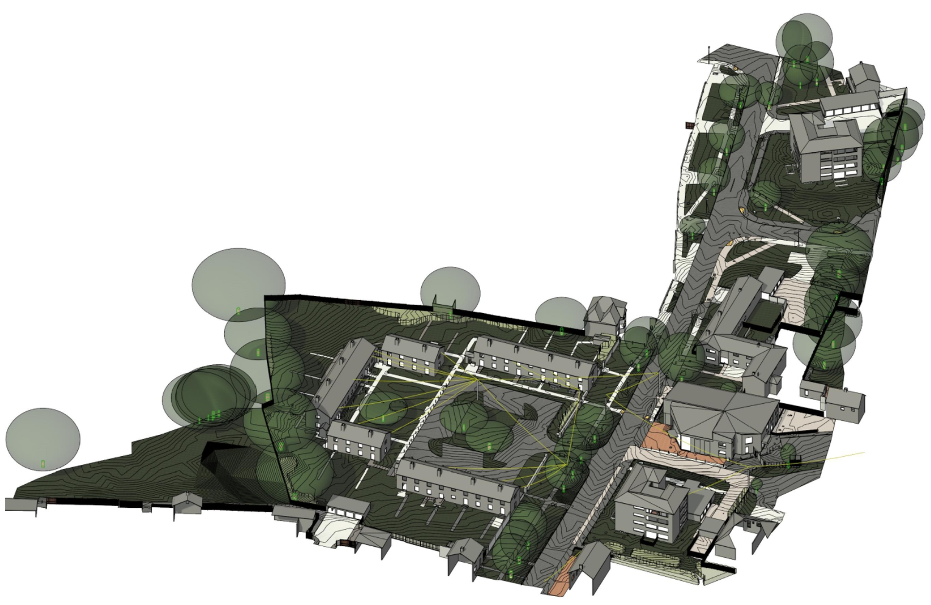
At Cura Surveys, we combine laser scanning, measured building survey experience, RTK GPS, drone surveys and point cloud processing to provide full coverage of complex buildings and sites. This allows us to capture internal spaces, external elevations, roof areas, structural details and difficult access zones with greater confidence.
Our models are created to an agreed level of detail, helping avoid unnecessary modelling costs while still giving your design team the information they need.
Why Choose Cura Surveys?
Cura Surveys is an RICS regulated survey company with extensive experience in measured building surveys, topographical surveys, 3D laser scanning and BIM modelling.
We have surveyed private homes, schools, commercial buildings, listed properties, historic estates, embassies, castles and complex development sites across the UK.
Clients choose us because we understand both the technical survey process and the practical needs of design and construction teams. Our deliverables are clear, accurate and suitable for planning, design coordination, refurbishment, redevelopment and construction workflows.
How it Works
- Project review
We review your brief, site information and required deliverables, including the model format, level of detail, survey extent and any planning or design requirements.
- Site laser scanning
Our surveyors attend site and capture accurate 3D scan data using professional laser scanning equipment. Where required, we can also include drone survey, RTK GPS and topographical survey data.
- Point cloud processing
The scan data is registered, checked and processed into a clean point cloud. This provides a precise digital record of the existing building or site.
- BIM modelling
Our team converts the point cloud into a Revit model or other agreed BIM format. The model is prepared to the agreed level of detail and aligned with the project requirements.
- Final delivery
We issue the agreed deliverables, which may include Revit models, point clouds, CAD drawings, elevations, sections, roof plans, floor plans and supporting survey information.
Who needs Scan to BIM?
Scan to BIM is useful for:
- Architects preparing planning, refurbishment or redevelopment designs
- Structural engineers needing reliable existing building geometry
- MEP consultants working around existing services and building constraints
- Contractors planning construction, fit out or coordination works
- Developers assessing existing buildings before purchase or redevelopment
- Heritage consultants working on listed or historic buildings
- Facilities managers needing an accurate digital record of an existing property
- Property owners planning extensions, alterations or major refurbishment works
- Replacement FAQ content for the section in your screenshot
Site work can take anything from a few hours to several days, depending on the size, complexity and accessibility of the building. A small property may only require half a day on site, while larger commercial, heritage or multi level buildings will take longer. We will confirm the expected timescale when preparing your quotation.
This depends on the size of the project, the level of detail required and the agreed deliverables. Smaller projects may be delivered within a few working days, while larger or more complex models usually require more time. We will provide a clear estimated delivery date before work begins.
The cost depends on the building size, survey extent, modelling detail, required outputs and site complexity. A simple model of a small property will cost less than a detailed BIM model of a large commercial, heritage or multi building site. We provide fixed quotations wherever possible, so you know the cost before instructing the work.
We can model to different levels of detail depending on the project requirements. For many architectural and design projects, a practical survey grade BIM model is sufficient. For complex heritage, structural or coordination projects, a higher level of detail may be required. We will advise what is appropriate so you do not pay for unnecessary modelling.
Yes. We can provide the registered point cloud alongside the BIM model. This is useful for future reference, design checks, clash review, visual inspection and additional modelling work later in the project.
Yes. Scan to BIM can support planning applications by providing accurate existing building information. We can also produce 2D CAD floor plans, roof plans, elevations and sections from the same survey data where these are required for planning or architectural submissions.
Typical deliverables include Revit models, DWG drawings, PDF drawings, RCS/RCP point clouds, E57 point clouds and other agreed formats. We will confirm the most suitable output based on your architect, engineer or contractor’s requirements.
Yes. Scan to BIM is particularly useful for listed buildings and historic properties, where structures are often irregular, detailed and difficult to measure using traditional methods alone. Laser scanning helps capture complex geometry accurately while reducing time on site and disturbance to the building.
Call us on 0203 488 5858 or email info@curasurveys.co.uk with your project details. We’ll provide a clear no-obligation quote (with no hidden costs) and feasible timescales.