
Combining Laser Scanning, Mobile Scanning and Drone Surveys
No single survey method is suitable for every part of a building or site.
Tripod laser scanning can capture detailed and accurate building information. Mobile scanning can cover large internal areas quickly. Drone surveys can record roofs, high-level features and wider external areas that may be difficult to access safely from the ground.
Cura Surveys combines these methods where appropriate to create complete and coordinated survey information for planning, design, refurbishment and construction.
Tripod Laser Scanning
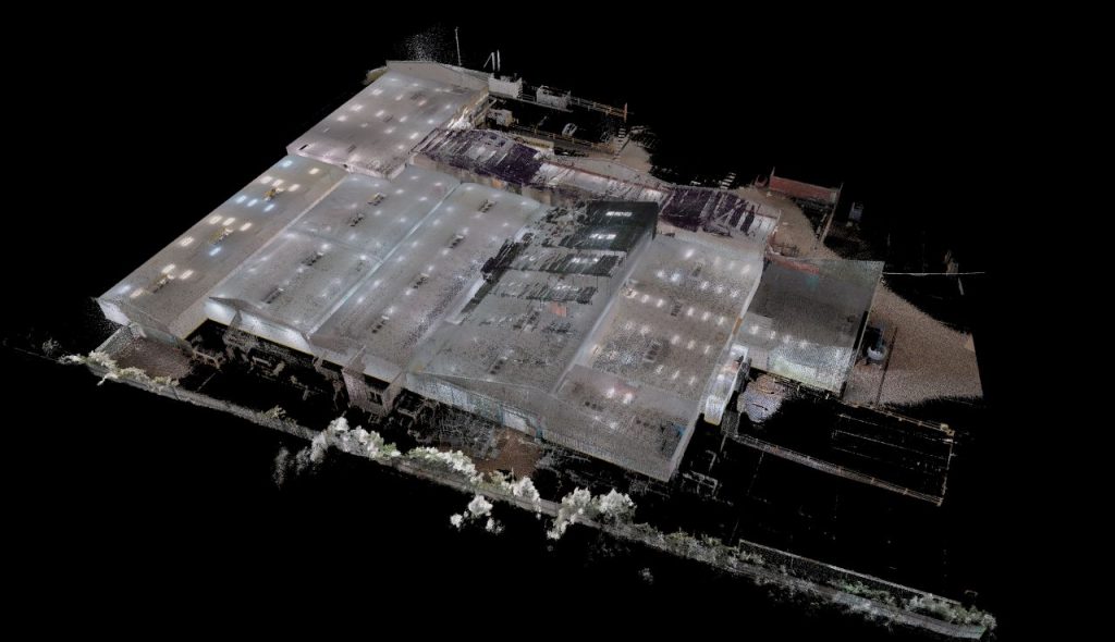
A tripod-mounted laser scanner records millions of measured points from a fixed position. Several scans are taken throughout the building or site and joined together to create a detailed three-dimensional record.
Tripod laser scanning is suitable for:
- Detailed measured building surveys
- Floor plans, elevations and sections
- Complex internal spaces
- Listed and historic buildings
- Structural and engineering surveys
- Accurate CAD drawings
- Revit and BIM models
It is normally used where accuracy and detailed building information are particularly important.
Mobile Scanning
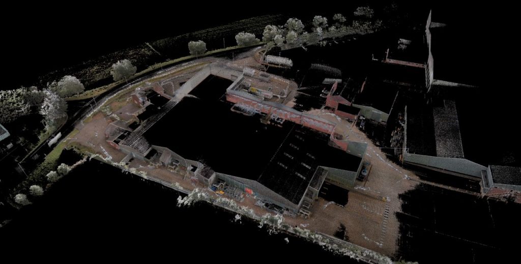
A mobile scanner is carried through the building while recording the surrounding space.
It can capture large areas efficiently, including:
- Corridors and circulation areas
- Offices and commercial buildings
- Schools and large estates
- Warehouses
- Plant areas
- Repeated rooms
- Connecting internal and external spaces
Mobile scanning can reduce site time, particularly on large buildings. However, detailed tripod scanning may still be needed in areas requiring greater accuracy or more information.
Drone Surveys
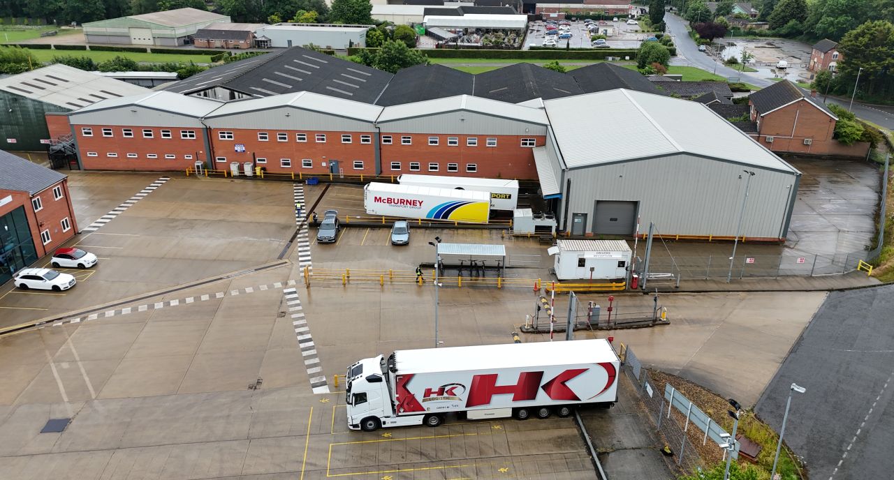
Drones can capture photographs and survey data from above the building or site.
They are useful for:
- Roofs and roof structures
- High-level building elevations
- Large external sites
- Difficult or unsafe access areas
- Surrounding buildings
- Site context and topographical surveys
- Construction progress records
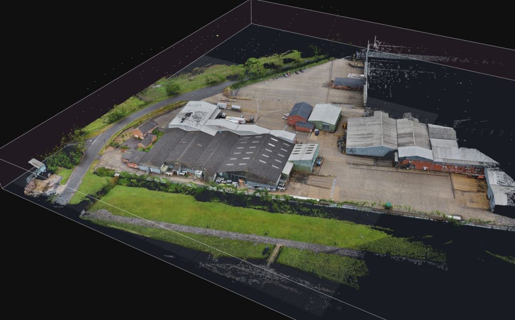
Drone data can be used to produce aerial images, three-dimensional models and external point cloud information.
Why Combine Different Survey Methods?
Large and complex projects often contain areas that need different approaches.
For example:
- Tripod laser scanning can capture detailed interiors and elevations.
- Mobile scanning can cover corridors and large internal areas quickly.
- Drone surveys can capture roofs and inaccessible external areas.
- Total station and satellite survey equipment can control the survey position and levels.
Combining these methods can provide more complete information while keeping the survey efficient.
It can also reduce:
- Missing roof and elevation information
- The need for expensive high-level access
- Repeat site visits
- Gaps between internal and external data
- Time spent surveying large repetitive areas
Keeping All Survey Data Coordinated
All survey information must be placed within the same coordinate and level system.
Survey control points are established so that tripod scans, mobile scans, drone data and external site information align correctly.
This allows the final CAD drawings, point clouds, Revit models and topographical surveys to work together as one coordinated survey package.
Choosing the Right Survey Method
The survey method depends on:
- Required accuracy
- Size and complexity of the building
- Internal and external survey extent
- Roof and high-level access
- Required drawings or models
- Available site access
- Project programme
- Final file formats
A small property may only require tripod laser scanning. A large estate or complex venue may benefit from a combination of tripod scanning, mobile scanning and drone surveying.
Typical Deliverables
A combined survey can provide:
- CAD floor plans
- Roof plans
- External elevations
- Internal elevations
- Building sections
- Reflected ceiling plans
- Topographical survey drawings
- Three-dimensional point cloud data
- Revit survey models
- Aerial photographs
- Three-dimensional site models
- Digital building and site records
When Is a Combined Survey Most Useful?
This approach is particularly useful for:
- Large or complex buildings
- Hotels and entertainment venues
- Schools and campus estates
- Listed and historic properties
- Commercial refurbishment projects
- Regeneration schemes
- Warehouses and industrial buildings
- Roof and elevation surveys
- Large external sites
- BIM and digital building-record projects
Need a Complete Building and Site Survey?
Cura Surveys provides tripod laser scanning, mobile scanning, drone surveys, topographical surveys, CAD drawings, point cloud data and Revit models across London and the UK.
Send us the site address, survey extent, required deliverables and programme for a fixed-fee quotation.
Posted on GoogleTrustindex verifies that the original source of the review is Google. We were particularly happy with how easy the whole process was to organise, from start to finish. Communication was clear and prompt throughout, and Lei was professional, friendly, and completely unobtrusive while carrying out the survey. The drawings are excellent and very clear, and we would happily recommend this company to anyone looking for this service.Posted on GoogleTrustindex verifies that the original source of the review is Google. Cura Surveys were wonderful. It took very little time to organise an appointment to measure my flat, and the measured survey came through on time. Additionally, Lei was kind enough to send me a PDF version with some specific measurements I needed which were otherwise very hard for me to calculate given that I don't have the software my architects/designers have.Posted on GoogleTrustindex verifies that the original source of the review is Google. Very efficient and professional.Posted on GoogleTrustindex verifies that the original source of the review is Google. Excellent service.Posted on GoogleTrustindex verifies that the original source of the review is Google. Cura Surveys offer & deliver a first class, attentive service. They are flexible and efficient. And the quality of the survey outputs are great. I thoroughly recommend Lei & the team.Posted on GoogleTrustindex verifies that the original source of the review is Google. Well donePosted on GoogleTrustindex verifies that the original source of the review is Google. We approached Lei for a building & topological survey in preparation for planing, such a lovely person and the plans were off a very high standard. I would strongly recommend this company, plans came back in a week, easy communication and very professional. My architect is very happy. They are also very reasonable with costs. Excellent all rounder. Thank you Lei. A very happy customer. ChantalPosted on GoogleTrustindex verifies that the original source of the review is Google. We are an Engineering company based in London and have worked with Lei on several occasions on various projects within the construction industry. The quality of scans are always excellent quality, and provide a very efficient service. We look forward to working with Cura surveys in the future.Posted on GoogleTrustindex verifies that the original source of the review is Google. We used Cura Surveys for two of the residential projects we have been involved with and we’re impressed with their level of professionalism. They were courteous on site and provided a complete and high quality survey. Wouldn’t hesitate to recommend.
Call us on 0203 488 5858 or email info@curasurveys.co.uk with your project details. We’ll provide a clear no-obligation quote (with no hidden costs) and feasible timescales.