
Roof and Surrounding Area Surveys for Airspace, Infill and Development
For airspace developments, infill schemes, extensions and new-build projects, surveying the main building alone is rarely enough.
Architects, developers and planning consultants need accurate information about the roof, neighbouring buildings, site levels, boundaries, windows, access routes and surrounding context. These details can directly affect the design, planning strategy, buildability and relationship between the proposed development and nearby properties.
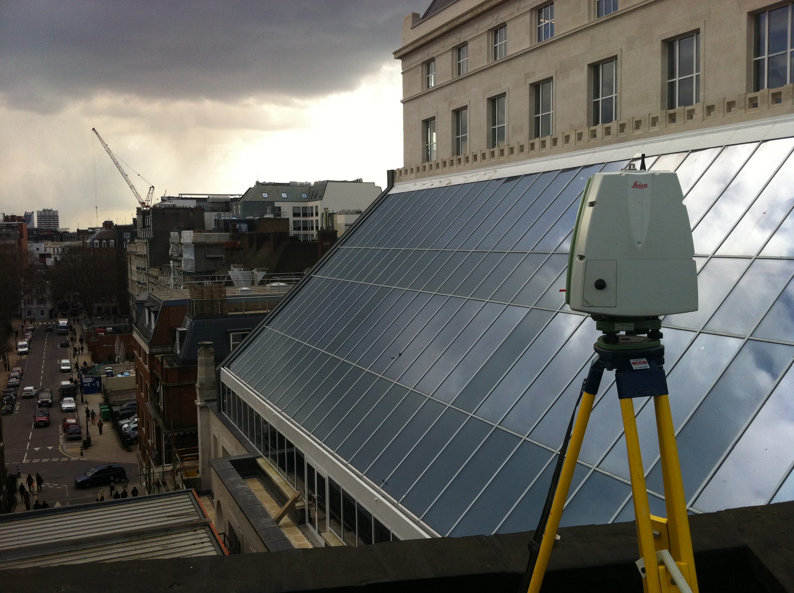
Cura Surveys combines tripod laser scanning, mobile scanning, telescopic scanning, drone surveys and controlled land-survey methods to provide comprehensive building and surrounding-area information within one coordinated dataset.
More Than a Standard Measured Survey
A standard measured building survey may accurately record the accessible areas of a property, but development projects often require a much wider understanding of the site.
Important information may be located:
- Above parapet level
- Behind roof obstructions
- On inaccessible roof areas
- Within adjoining courtyards
- Across neighbouring buildings
- Beyond walls and boundaries
- At high-level façades and windows
- Within narrow gaps between properties
- Across large external development areas
Our multi-method survey capability helps overcome these difficulties and capture information that may be missed when only one surveying method is used.
The result is not simply a set of plans. It is a comprehensive existing-condition record that helps the project team make informed decisions.
Suitable for a Wide Range of Development Projects
Detailed roof and surrounding-area surveys are particularly valuable for:
- Airspace developments
- Rooftop extensions
- Additional storeys
- Infill developments
- New-build schemes
- House and commercial extensions
- Loft conversions
- Rear and side extensions
- Roof plant installations
- Major refurbishment projects
- Rights of light assessments
- Daylight and sunlight studies
- Planning applications
- Construction-access planning
Understanding the Wider Site
Development proposals must respond to more than the dimensions of the existing building.
The design team may need accurate information about:
- Existing roof shapes and slopes
- Parapets, ridges and eaves
- Chimneys, rooflights and dormers
- Rooftop plant and structures
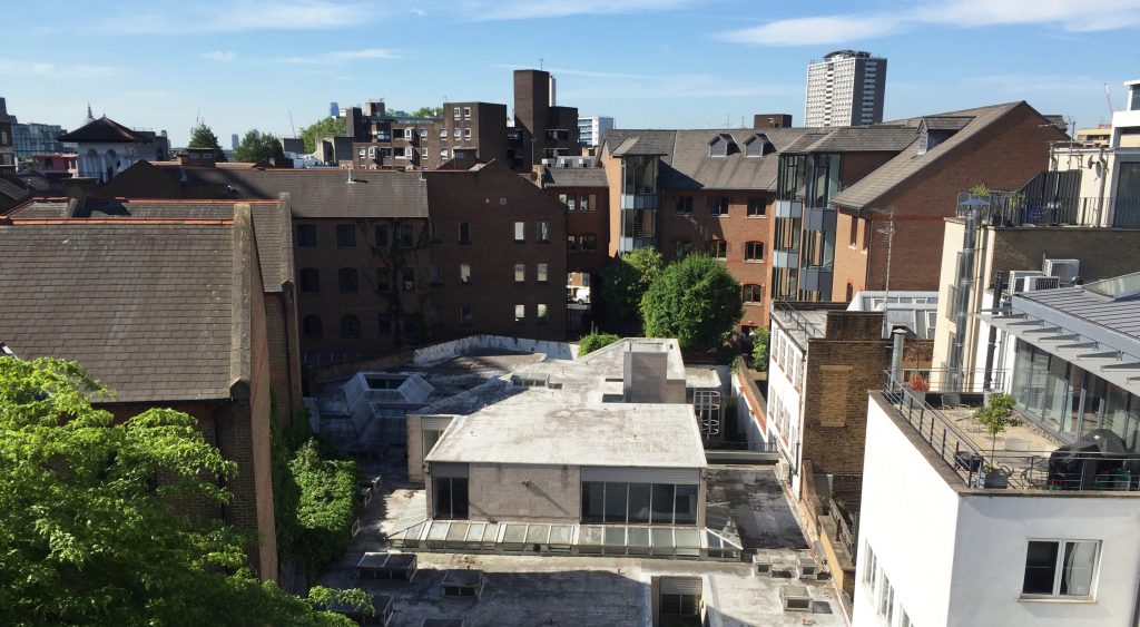
- Neighbouring roof levels
- Surrounding building heights
- Adjacent windows and openings
- Balconies and terraces
- Site boundaries and walls
- Ground levels and access routes
- Roads, pavements and nearby structures
- The relationship between existing and proposed development
Capturing this wider context allows architects and consultants to assess design opportunities and constraints using measured information rather than estimates.
Combining Different Survey Technologies
No single survey method can capture every part of a complex building or development site effectively.
Tripod Laser Scanning
Tripod laser scanning provides accurate and detailed information for accessible interiors, elevations, terraces, structures and external areas.
It is particularly valuable where precise geometry is required for CAD drawings, building sections and Revit models.
Mobile Scanning
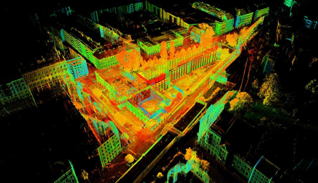
Mobile scanning allows large internal, roof and external areas to be recorded efficiently.
It is useful for circulation routes, repetitive spaces, plant areas, extensive roofs and connecting areas between buildings.
Telescopic Scanning
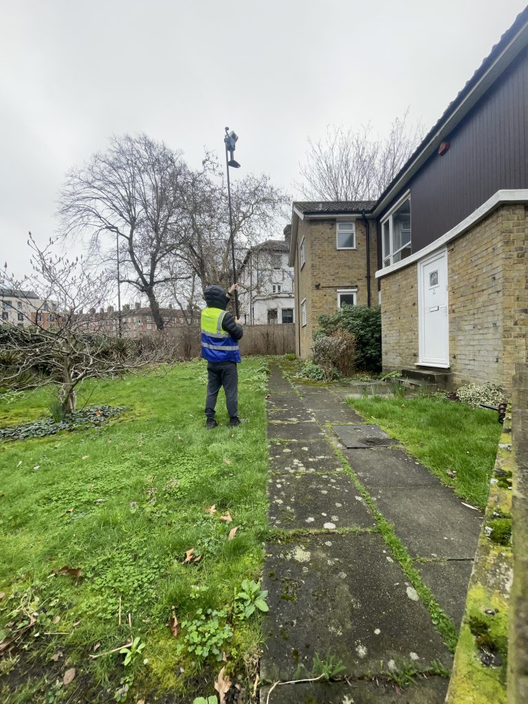
Mounting mobile scanning equipment on a telescopic system allows data to be captured above parapets, walls, fences and other visual obstructions.
This can reveal roof surfaces, gutters, hidden areas and surrounding features that cannot be seen from normal ground-level survey positions.
Drone Surveys
Drone surveys provide valuable coverage of roofs, high-level façades, surrounding buildings and wider development sites.
They can reduce the need for scaffolding or powered access while providing aerial photography, roof information and three-dimensional survey data for areas that are difficult or unsafe to reach.
Survey Control
Total stations and satellite survey equipment are used to coordinate the different datasets within the same position and level system.
This ensures that internal scanning, roof information, drone data and surrounding-site measurements work together accurately.
Comprehensive Survey Coverage
By combining several survey methods, Cura Surveys can provide significantly more complete coverage than a survey relying on one instrument alone.
This approach can reduce:
- Missing roof information
- Hidden areas behind parapets
- Gaps between internal and external surveys
- Inaccurate neighbouring-building heights
- Assumptions about surrounding windows and structures
- Repeat site visits
- Dependence on outdated drawings
- Design changes caused by incomplete information
Complete coverage remains subject to physical access, visibility, permissions and site restrictions, but our methodology is designed to maximise the amount of reliable information captured during the survey.
Supporting Informed Design Decisions
A comprehensive survey helps the project team answer important questions early:
- Is there sufficient space for the proposed development?
- How will the new design relate to neighbouring buildings?
- What roof levels and structures affect the proposal?
- Are nearby windows, boundaries or access routes likely to influence the design?
- Can construction access and temporary works be planned effectively?
- Is further specialist assessment required?
- Does the planning design accurately reflect the existing site?
Better information at the beginning of the project supports better feasibility, planning, design and construction decisions.
Survey Deliverables
Depending on the project, deliverables can include:
- Measured floor plans
- Detailed roof plans
- Topographical survey drawings
- External elevations
- Building sections
- Surrounding-building information
- Window and opening locations
- Site and boundary data
- Three-dimensional point clouds
- Revit survey models
- Three-dimensional CAD models
- Aerial photographs
- Roof imagery
- Surface and terrain models
- Data for rights of light, daylight and sunlight consultants
Why Cura Surveys?
Cura Surveys has the equipment, experience and in-house technical capability to combine building, roof and surrounding-area data into one coordinated survey package.
Our capability includes:
- Tripod laser scanning
- Mobile scanning
- Telescopic scanning
- Drone surveys
- Total station and satellite survey control
- Topographical surveys
- CAD drawing production
- Revit and BIM modelling
- Point cloud processing
- Complex urban and difficult-access surveys
Rather than applying the same method to every project, we select the most effective technology for each part of the building and site.
This provides architects, developers and consultants with the reliable and comprehensive information needed to understand the existing environment, assess opportunities and make informed project decisions.
Planning an Airspace, Infill, Extension or New-Build Project?
Cura Surveys provides coordinated building, roof and surrounding-area surveys for airspace developments, infill schemes, extensions, new-build projects and complex planning applications across London and the UK.
Send us the site address, proposed development information, required survey coverage and deliverables for a fixed-fee quotation.

Posted on GoogleTrustindex verifies that the original source of the review is Google. We were particularly happy with how easy the whole process was to organise, from start to finish. Communication was clear and prompt throughout, and Lei was professional, friendly, and completely unobtrusive while carrying out the survey. The drawings are excellent and very clear, and we would happily recommend this company to anyone looking for this service.Posted on GoogleTrustindex verifies that the original source of the review is Google. Cura Surveys were wonderful. It took very little time to organise an appointment to measure my flat, and the measured survey came through on time. Additionally, Lei was kind enough to send me a PDF version with some specific measurements I needed which were otherwise very hard for me to calculate given that I don't have the software my architects/designers have.Posted on GoogleTrustindex verifies that the original source of the review is Google. Very efficient and professional.Posted on GoogleTrustindex verifies that the original source of the review is Google. Excellent service.Posted on GoogleTrustindex verifies that the original source of the review is Google. Cura Surveys offer & deliver a first class, attentive service. They are flexible and efficient. And the quality of the survey outputs are great. I thoroughly recommend Lei & the team.Posted on GoogleTrustindex verifies that the original source of the review is Google. Well donePosted on GoogleTrustindex verifies that the original source of the review is Google. We approached Lei for a building & topological survey in preparation for planing, such a lovely person and the plans were off a very high standard. I would strongly recommend this company, plans came back in a week, easy communication and very professional. My architect is very happy. They are also very reasonable with costs. Excellent all rounder. Thank you Lei. A very happy customer. ChantalPosted on GoogleTrustindex verifies that the original source of the review is Google. We are an Engineering company based in London and have worked with Lei on several occasions on various projects within the construction industry. The quality of scans are always excellent quality, and provide a very efficient service. We look forward to working with Cura surveys in the future.Posted on GoogleTrustindex verifies that the original source of the review is Google. We used Cura Surveys for two of the residential projects we have been involved with and we’re impressed with their level of professionalism. They were courteous on site and provided a complete and high quality survey. Wouldn’t hesitate to recommend.
Call us on 0203 488 5858 or email info@curasurveys.co.uk with your project details. We’ll provide a clear no-obligation quote (with no hidden costs) and feasible timescales.