


London Borough of Southwark
Introduction:
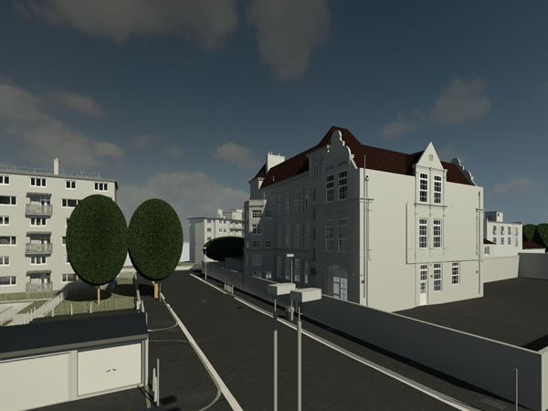
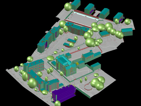
This case study presents a detailed account of a Revit Building Information Modelling (BIM) survey conducted for a large council estate located in the London Borough of Southwark. The primary objectives of the survey included town planning, regeneration, air space analysis, and rights of light considerations. The resulting LOD3 equivalent surveyed Revit model received positive feedback from both the Council and the architects involved in the project.
Background:
The council estate in Southwark was chosen for comprehensive town planning and regeneration efforts. The site’s large-scale redevelopment required an accurate and detailed survey to inform the design process and assess various factors such as air space utilization and rights of light.
Objectives: The key objectives of the Revit BIM survey were as follows:
- Create a high-quality LOD3 equivalent surveyed Revit model of the council estate.
- Capture accurate topographic and building information to support town planning and regeneration efforts.
- Conduct air space analysis to optimize development potential.
- Assess rights of light to ensure compliance with regulations and minimize potential infringements.
Laser Scanning and Total Station:
Laser scanning technology was utilized to capture precise measurements of the existing buildings and topography of the council estate. The scanning process collected a vast amount of data, enabling the creation of a detailed three-dimensional representation of the site. Total stations were used in conjunction with the laser scanning to obtain accurate coordinates for control points, ensuring precise georeferencing of the survey data.
GPS and Survey Control Network:
Global Positioning System (GPS) technology was utilized to establish accurate horizontal and vertical control for the survey. A survey control network was strategically placed throughout the site to ensure consistent and precise geospatial reference points for all survey data. This control network played a vital role in aligning the collected laser scanning and total station data.
Long-Range Scanning from Roof:
To capture the surrounding environment and neighbouring buildings, long-range scanning techniques were employed from the vantage point of the council estate’s roof. This data was incorporated into the Revit model, providing a comprehensive understanding of the site’s context.
Detailed Topographic and Building Information:
The survey team meticulously recorded and documented detailed topographic and building information using the laser scanning data. This included the accurate representation of existing structures, terrain features, roads, pathways, and vegetation. The resulting data facilitated informed decision-making during the town planning and regeneration processes.
Results and Deliverables:
LOD3 Equivalent Surveyed Revit Model:
A high-quality LOD3 equivalent surveyed Revit model was created, incorporating accurate 3D representations of the existing buildings, terrain, and other site features. The model served as a comprehensive digital representation of the council estate, enabling efficient design, analysis, and visualization.
Air Space Analysis:
The survey provided valuable data for conducting air space analysis, enabling the optimization of development potential while considering height restrictions, planning regulations, and neighbouring buildings’ impact on sightlines.
Rights of Light Assessment:
The survey facilitated a thorough rights of light assessment, ensuring compliance with relevant regulations and minimizing potential infringements that could impact neighbouring properties’ access to natural light.
Conclusion:
The Revit BIM survey of the large council estate in the London Borough of Southwark successfully provided accurate topographic and building information, facilitating town planning, regeneration, air space analysis, and rights of light considerations. The resulting LOD3 equivalent surveyed Revit model received positive feedback from both the Council and the architects involved in the project, demonstrating its value in supporting informed decision-making and efficient design processes.